


SO Weissenstein -Grenchenberg

hrb
Utilisateur
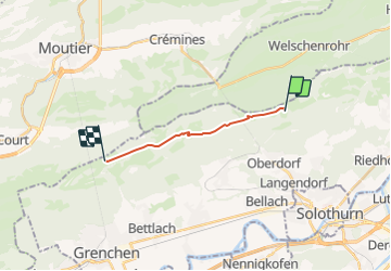

Longueur
9,7 km

Altitude max
1431 m

Dénivelé positif
511 m
Km-Effort
16,3 km

Altitude min
1173 m

Dénivelé négatif
445 m
Boucle
Non
Date de création :
2014-12-11 00:00:00.0
Dernière modification :
2014-12-11 00:00:00.0
--
Difficulté : Inconnu

Application GPS de randonnée GRATUITE
 SityTrail
IGN / Instituts géographiques
SityTrail Plus
Le monde est à vous
À propos
Randonnée Autre activité de 9,7 km à découvrir à Soleure, Bezirk Lebern, Oberdorf (SO). Cette randonnée est proposée par hrb.
Description
Mit Grottenbesichtigung, Quelle der Orbe
Localisation
Pays :
Suisse
Région :
Soleure
Département/Province :
Bezirk Lebern
Commune :
Oberdorf (SO)
Localité :
Unknown
Départ:(Dec)
Départ:(UTM)
387285 ; 5234269 (32T) N.
Commentaires